An Archaeological Summary of the
Islands of the Sun and the Moon
The Inca Empire, was one of the greatest states to develop in the
Americas. Last in a series of indigenous complex Andean societies, it
emerged from the Cuzco region, expanded across the western highlands
and coast of South America, and ultimately encompassed a territory
that stretched from modern day Colombia to Chile. By the time of
European contact in 1532, the Inca state controlled a population of
at least six million (Map).
The Islands of the Sun and the Moon were two of the most sacred
places in the Inca State. There were hundreds of religious shrines
throughout the Inca empire. These sacred locations were known as
huacas. They held critical roles in defining the cultural topography
of the Andes and the lives of the indigenous peoples who lived there.
The Inca themselves worshipped many such huacas. Their cosmology,
however, placed paramount importance on the sun. Conquered peoples
were not required to abandon their own huacas, but were compelled to
acknowledge the superiority of the sun and its Inca descendants.
The thousands of huacas in the Andes at the time of the Spanish
invasion varied in size and significance from shrines of pan-Andean
importance, such as the Island of the Sun, to local objects
worshipped by a single family. Contact with a huaca required signs of
respect: a prayer or an offering, or more typically both. The most
powerful huacas required conspicuous amounts of goods for their
maintenance and were attended by hundreds, if not thousands, of
individuals. These shrines were often established by the Inca state
to be self-sufficient and controlled considerable areas of
agricultural land and large camelid herds. Offspring of the animals
and produce from the fields were sacrificed to the huaca and used to
support its attendants.
When the first Spaniards arrived in the Titicaca region in the
1530's, they learned of indigenous huaca worship and its central role
in Andean world views. They were told that the sun had emerged for
the first time from a sacred island in a great inland lake called
Titicaca. They were also informed that this island housed a series of
ancient temples -- the largest of which stood beside the revered rock
of the sun -- and that the Inca, after their conquest of the region,
continued to worship this island as the origin point of the sun.
Francisco Pizarro, the leader of the invading forces, sent three men
to investigate this island. The expedition arrived at the lake in
1534 and left an eyewitness account of the massive Inca presence at
the sanctuary.
This initial visit to the Island of the Sun by Europeans was
followed by many others. The finest descriptions of the island come
from the priests who lived along the shores of Lake Titicaca during
the early seventeenth century. These include the writings of a Jesuit
priest named Bernabé Cobo (1653) and the works of two
Augustinians, called Alonso Ramos Gavilan (1612) and Antonio de la
Calancha (1638). Cobo, one of the most accurate of the early Andean
historians, provides an extensive summary of Inca activities on the
Island of the Sun. Cobo personally visited the island in 1616 and
observed that:
". . . Inca had many buildings constructed in order to enlarge and
lend more authority to this shrine. The former temple was augmented
with new and impressive buildings. In addition, it was ordered that
other buildings be constructed for other purposes; these included a
convent for mamaconas [chosen women] which was placed here,
many magnificent lodgings and rooms to serve as a dwelling place for
the priest and attendants, and one quarter of a league before one
reaches the temple, there was an impressive tambo or inn for the
pilgrims to stay in . . . The ruins of these storehouses remain to
this day, and I have seen them myself. . ."
Because the Island of the Sun was a major center for the Inca,
facilities were maintained by individuals brought in as colonists
directly from Cuzco, the capital of the empire. Cobo, who states that
two thousand colonists were transported to the island by the Inca,
writes: "[the Inca] brought in other people from Cuzco, in
whom he could put the trust that the gravity of the case required. He
made a moderate-sized town one league from the temple, and the
majority of the inhabitants were colonists of Inca blood and
lineage."
Cobo's descriptions of the Island of the Sun are supported by
those of Ramos Gavilan and Calancha. Both of these authors, like
Cobo, provide extensive eye-witness accounts of the Inca remains on
the island, what offerings where made to the sacred rock, how
pilgrimages where conducted there, and the network of paved trails
which took the pilgrims from the southern end of the island to the
shrine complex on the northern end. Perhaps most importantly, Cobo,
Ramos Gavilan, and Calancha all provide detailed descriptions of the
Inca shrine complex which included the sacred rock or "Titikala", a
temple to the Sun and other deities, and a large labyrinth-like
structure which housed the Mamacona ("chosen women" of the Inca who
attended the shrines). Furthermore, each of these early writers state
that the Inca built their temples on the remains of older ones and
that the Island of the Sun was worshipped long before the Inca
arrived there. We also learn from these earlier writers that a large
temple was built on the Island of the Moon which was staffed by only
females. These caretakers, and the temple it itself, were dedicated
to the cult of the Moon, which was closely associated with feminine
elements of the cosmos.
There are about a dozen major Inca sites on the Islands of the Sun
and the Moon, and approximately 80 Inca sites in total. Most Inca
sites are not recognizable, since they were composed of small hamlets
located on the hillsides. They survive as only scatters of Inca
pottery in farmed fields. The most notable sites visible with
standing Inca architecture were not the locations of commoners, but
were instead institutions built and maintained by the Inca state.
When the Inca occupied these islands, they repaired and expanded
the ancient road system (see map). Archaeologists have been able to
trace this road system. Inca roads were 2-3 meters wide, and
sometimes paved with flagstones. You can still see sections of the
original prehistoric pavement on many parts of the island. You will
also notice a number of now-ruined drainage canals, about 20 cm wide,
on parts of the road, which were built by the prehistoric peoples to
prevent erosion.
The First Peoples of the Islands
The Inca were not the first occupants of the Titicaca Region.
Archaeological research has demonstrated that humans first settled
the lake region around 7000 B.C. and we have evidence of settlement
of the Island of the Sun by at least 2000 B.C. In the last few years,
archaeologists have excavated a site in the community of Challa that
was one of the first human occupations on the island. The site is not
visible from the surface, but it is located in between two streams
above the plain. This would have been an ideal location to live since
it had a continual source of fresh water, was close to the lake for
fishing, and provided a good base area from which to hunt.
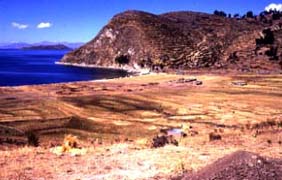 Sometime
around 1200-800 B.C., the peoples of the Titicaca Basin and its
islands began to plant food and domesticate llamas and alpacas.
Today, you can see thousands of agricultural terraces covering the
island. Many of these terraces are used today, but most were probably
built hundreds, or thousands of years ago. In the plain of Challa you
can see the remains of ancient raised fields and canals, built very
early to farm this rich area. From a distance, the fields look like
giant waffles. They were used to raise the soil out of swampy areas
and make rich growing platforms. Canals from the hills above fed the
fields with fresh water. Raised fields were a very sophisticated
agricultural technique used by the people on the island for thousands
of years. Like others elsewhere in the Titicaca region, the Challa
raised fields were abandoned around A.D. 1100, probably due to a
progressive drought. (See photo above.)
The Tiwanaku Peoples
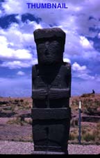 Around
A.D. 500, the great high plateau state of Tiwanaku emerged as the
dominant culture of the region. The capital of Tiwanaku is located in
the southern Lake Titicaca Basin in the Tiwanaku Valley of Bolivia.
At over 3800 meters above sea level, Tiwanaku ranks as one of the
highest ancient imperial capitals in the world. The site was founded
around 400 B.C. as a modest village. By A.D. 900, Tiwanaku influence
and control extended over 350,000 square kilometers, an area larger
than modern Great Britain. During its peak, the capital of Tiwanaku
boasted a huge stone-faced pyramid, cut stone enclosures, elite
residences, exquisitely decorated buildings, a system of subterranean
canals, and at least four square kilometers of residential buildings.
The Tiwanaku imperial economy was based on the intensive utilization
of raised fields, camelid pastoralism, terrace agriculture, an
extensive exchange and colonial system, and the organization of large
numbers of laborers for state projects. There was a rigid social and
political hierarchy expressed in elaborate art and architectural
styles.
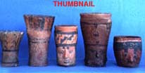 The
Islands of the Sun and the Moon were important to the Tiwanaku State.
There is a cluster of Tiwanaku settlements near the Sacred area on
the Island of the Sun that includes a site called Chucaripupata. This
site is at least six hectares in size and may be the largest Tiwanaku
occupation on the island. The pottery from the site is very fine,
indicating that the people who lived in Chucaripupata were of noble
status and that important rituals were conducted there. Excavations
on the Island of the Moon have recovered Tiwanaku offerings beneath
its major Inca ruins as well. These findings indicate that the Inca
were not the first to worship these islands as the origin places of
the Sun and the Moon but that these religious traditions extend back
to the Tiwanaku people.
The
Islands of the Sun and the Moon were important to the Tiwanaku State.
There is a cluster of Tiwanaku settlements near the Sacred area on
the Island of the Sun that includes a site called Chucaripupata. This
site is at least six hectares in size and may be the largest Tiwanaku
occupation on the island. The pottery from the site is very fine,
indicating that the people who lived in Chucaripupata were of noble
status and that important rituals were conducted there. Excavations
on the Island of the Moon have recovered Tiwanaku offerings beneath
its major Inca ruins as well. These findings indicate that the Inca
were not the first to worship these islands as the origin places of
the Sun and the Moon but that these religious traditions extend back
to the Tiwanaku people.
The Great Aymara Kingdoms
The collapse of the Tiwanaku state around A.D. 1100 ushered in the
period known in Quechua as the "Auca Runa" or "time of warriors." For
the Lake Titicaca region this was a time of regional development as
the separate lake groups which had once been under the control of
Tiwanaku reformulated themselves into independent polities. This was,
however, also a period of intense warfare and small political
entities built huge fortified villages. During this period,
population on the islands declined dramatically and the local
political and economic organization collapsed.
There are a number of small sites of this time period on the
islands. The large hill called Cerro Pucara in the middle of the
Island of the Sun has a series of walls that may have been used for
defense. The word "pucara" means "fortress" in Aymara and Quechua.
There are other sites as well, but you can not see any houses or
other structures on the settlements because the walls have since
collapsed.
The Inca occupation
Of course, it is during the Inca conquest the we enter into the
proto-historic period where our 16th century documents provide
detailed information. During the Inca Period there was an increase in
population on the islands. Like the earlier Tiwanaku occupation, many
of the Inca sites are located in the sanctuary area. The Sacred Rock
area has an impressive cluster of settlements, including standing
Inca architecture adjacent to the rock. Furthermore, Cobo's remark
that the Inca constructed two large village sites on the island is
corroborated by archaeological survey data: the village sites of
Kasapata and Apachinaca correspond remarkably well to his description
of the location and size of these villages. The Challa area in the
middle of the island was the most important prehispanic agricultural
zone. This area continued to be occupied during Inca times, although
the primary occupational zone for the Inca expanded across the bay to
the Challapampa region. The Inca occupation, in fact, represents the
highest population levels of the Island of the Sun until recent
times.
The Islands of the Sun and the Moon were incorporated into the
Inca empire in the middle of the 15th century A.D. As we discussed
earlier, the Inca, following the beliefs of the Tiwanaku peoples
hundreds of years earlier, created a great pilgrimage center on these
islands. As you visit the islands you have a unique opportunity to
see many of these archaeological sites. However, please remember that
archaeological sites are unique and irreplaceable resources. They are
our most important means of understanding the past lives of the
Andean people. Do nothing to disturb the sites and take nothing from
them.
Major Archaeological Sites on the Island of the Sun and the
Moon
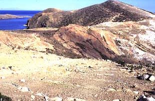 The Sanctuary Area
The focal point of solar worship for the Inca and other
prehistoric cultures on the Island of the Sun was the rock from which
the sun first rose, near the northern end of the island. This area is
separated from the rest of the island by an east-west running wall
(Photo ), and contains three separate clusters of well preserved Inca
buildings and a large Tiwanaku site. The northern end of the
sanctuary area is defined by a small ridge that forms the
northwestern horizon.
One of the most detailed descriptions of pilgrimages to the island
comes from Bernabé Cobo. According to this author, the
pilgrims first arrived at the town of Yunguyo, about seven kilometers
from Copacabana, and it is interesting to note that Yunguyo still
marks the boundary between Bolivia and Peru. In Inca times, access
beyond Yunguyo was restricted, and available only to pilgrims,
priests, and those who maintained fields on the island. To gain
access, the pilgrims had to speak with a confessor, and do penitence.
They also abstained from salt, meat, and chile peppers, after which
they could proceed to Copacabana, where a second confession was made.
They then traveled by boat from the mainland beyond Copacabana to the
island and walked to its northern end. Ultimately, most pilgrims were
not allowed to enter the sanctuary. Instead, they arrived at the
wall, about 200 paces from the sacred rock. At a gate called
Intipunku (Sun Gate), from where the Sacred Rock is first seen, the
pilgrims handed their offerings to the priests of the shrine.
Many of the features that Cobo mentions are still identifiable.
The sanctuary wall beyond which the pilgrims could not pass, is today
a low mound of stone that crosses the island. The sacred rock is a
large uncut crag of red sandstone. Cobo also describes a large
architectural complex that is today called the Chincana, and notes
the presence of a small set of buildings now called Mama Ojlia and a
set of natural marks on the bedrock which were believed to be the
footsteps of the first mythical Inca, Manco Capac. On the other hand,
some features that Cobo mentions, like a round altar stone in front
of the rock no longer exist. This round stone had a hole into which
large amounts of chicha (corn beer) were poured during ceremonies.
Although this offering spot has been destroyed by looters, recent
archaeological excavations in the area have recovered remains of a
fine stone canal which drained the liquid offerings from the rock
area.
 The Sacred Rock (Titikala)
The sacred rock from which the sun rose is a large exposed slab of
reddish, sandstone, that lies near the center of the sanctuary area.
A small U-shaped plaza was constructed adjoining this rock. The
southwest side of the plaza is defined by the Inca road which leads
from the sanctuary to the elaborate Inca remains of the Chincana. It
was in this plaza, near the rock that Cobo saw the round hole into
which chicha was poured as an offering to the sun. The far-side of
the rock descends much of the distance down to the lake. Cobo calls
this broad descending side, "the convex side of the stone," and says
it was covered in cumbi, a finely woven cloth. He states that the
plaza side of the rock was covered with sheets of gold and that an
alter was located in the prominent concavity near its center.
There is currently a table-like-rock across the Inca road from the
Sacred Rock. Photographs of the site taken in the early 1900's
indicate that this rock is not in its original position. It was most
likely unearthed during one of the many looting episode which the
area as suffered and has only recently been placed in its current
position.
 The Chincana
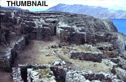
About 300 meters southwest of the rock is an elaborate Inca ruin
called the Chincana (the labyrinth), which offers impressive views of
the lake and the far distant shore of Peru. Its walls, constructed
with field stones and earth mortar, were once covered with mud
plaster and painted various colors. The Chincana contains the
trapezoidal doors and niches indicative of Inca architecture. While
these superficial Inca elements are abundant, the overall plan of the
complex is distinct from those found in the Cusco area. In the Inca
heartland, and in most Inca administrative centers elsewhere in the
empire, Inca structures were constructed in the form of a cancha
(enclosure), formed by three or four independent structures around a
rectangular, or square, courtyard area. In contrast to this basic
cannon of Inca architecture, there are many rooms within the Chincana
connected by twisting passageways. The multiple passageways and
internally connected rooms lend a maze-like feeling to this complex.
Following information provided by the early Colonial writers
archaeologists believe that the Chincana was a support facility for
the shrine complex and it housed the women who cared for the
shrine.
Mama Ojlia
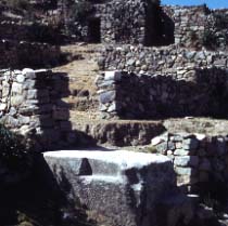
The small site of Mama Ojlia is located halfway between the
sanctuary gateway and the Sacred Rock. There are the poorly preserved
remains of two or three small structures above the trail and those of
a large structure below. Excavations in these buildings have
recovered carbon remains adjacent to Inca pottery which provided
dates of A.D. 1450 and A.D. 1490. Cobo suggests that the large
structure may have served as a Temple of the Sun. The so-called
footprints of Manco Capac are found between this small site and the
Sacred Rock.
Chucaripupata
This is a large pre-Inca site located within the shrine complex.
It is situated approximately 200 meters southeast of the sacred rock.
The site was first noted by the Swiss archaeologist Adolph Bandelier
in 1894 during his fieldwork on the island, and he accurately
described the site as a quadrangular platform "lined by walls and
surrounded by lower terraces on three sides, . . . " Many of
Bandelier's archaeological finds from this site as well as his
collections from other sites on the Islands of the Sun and the Moon
can be seen in the American Museum of Natural History in New
York.
June Solstice Observations from the Rock Area
On the June solstice (21 June), the sun can be seen, from the
sacred rock plaza, to sets between two, small, poorly preserved
structures on the northwest ridge. On this same day, the sun can also
be seen to set between these structures from a platform on the ridge
just outside of the sanctuary wall. Research on Inca astronomy
indicates that these markers were built on the ridge by the Incas to
mark this important day. The Inca elites most likely watched this
annual event from the plaza area, while the commoners watched it from
the platform area outside the sanctuary.
Other Major Sites on the Island of the Sun
There are a number of other notable archaeological sites outside
of the sanctuary area on the Island of the Sun.
Kasapata
Kasapata is a large Inca site with standing architecture, located
approximately 30 minutes on the sanctuary road from Challapampa. The
site conforms to the description of a large Inca village described by
Cobo. Large, cut stone blocks dot the landscape, suggesting that a
public structure was situated near the center of the site. There is a
single building about 40 meters long which can be seen from the
trail. (Visitors are asked not to enter these ruins since it involves
cutting across several agricultural fields). This large building was
not a "palace" as some have suggested but was a typical Inca "tambo"
or way station where travelers were housed and fed. Archaeological
research demonstrates that the site was a densely occupied village,
located in prime maize-growing land.
Tintinhuayani
The site of Tintinhuayani, located above the plaza in the
community of Challa, is the principal pre-Tiwanaku site on the island
of the Sun. Although little architectural remains are visible on the
surface today, excavations at the site indicate that it was settled
by at least 1500 B.C., and that it was occupied continually to around
A.D. 100. In its earliest periods, Tintinhuayani was a major workshop
of imported obsidian, a sharp volcanic glass quarried far away in the
mountains. Around 200 B.C. or so, Tintinhuayani was the center of a
culture that included the entire island and was contemporary with
other important sites such as Chiripa and Early Tiwanaku on the
mainland. Excavations indicate that during its height, the
Tintinhuayani people's built a large plaza complex on the top of the
hill, probably surrounded by cut stones.
Apachinaca
This site is located on the ridge separating the communities of
Yumani and Challa, along the major road leading to the Sacred Rock.
It is a large site with a continuous occupation from at least the
Tintinhuayani Period (ca. 200 B.C. - A.D. 400) to the Inca Period.
Although this site now largely appears as a series of cultivated
fields, it was most likely one of the Inca villages described by
Cobo, and may have housed many of the colonists brought in from the
Cuzco region.
Fountain of the Inca and Pilco Kayma
 The
major Inca port for the island was located on its southeastern tip,
the point of land closest to the mainland. From the boat you can see
a line which runs from this point up to the village of Yumani. This
is the Inca road which lead arriving pilgrims to the sanctuary area.
Below this trail are the two most visited sites on the Island of the
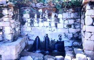
Sun: the Fountain of the Inca and Pilco Kayma. The Fountain of the
Inca is located in a lush crescent of the island, now shaded with
eucalyptus trees (an nineteenth century introduction). There is a
long stairway to the fountain which rests in the middle of the hill
slope. The fountain is still used by the people of Yumani, since
their village has no water. The fountain area offers a beautiful of
view of the Bolivian cordillera as well as the Island of the
Moon.
A short boat ride, or a 20 to 30 minute walk, will take you from
the fountain to the Inca ruins of Pilco Kayma. This is an exceptional
two story building once covered in mud plaster. It is best known for
its closely clustered interior chambers, its large corbeled vaults,
and its large doors which face the lake. Like the major ruin on the
Temple of the Moon, this structure portrays a mixture of classical
Inca and regional Lake Titicaca architectural features.
The Museum at Challapampa
There is a small museum in Challapampa that has ancient pottery
and some metal objects. Many of the objects come from Johan
Reinhard's underwater research near the northern end of the island,
while other have been donated by the people of the Challapampa. The
museum is open on an as-need basis. Ask your guide or people in the
community to let you into see the exhibit. There is a small entrance
fee.
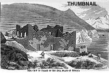 Iñak Uyu (The Temple of the Moon)
One of the best preserved ruins of the Lake Titicaca region can be
seen on the small Island of the Moon (also called the Island of
Coati). The ruins, Iñak Uyu, are located on the northern side
of the island and an impressive set of terraces lead from the dock to
them. As one enters Iñak Uyu there is a large terrace wall
built with finely fitted classic Inca stone masonry. A compound rests
above this wall which the early historians of the region tell us was
a Temple of the Moon staffed with female attendants. The 19th century
explorer and diplomat Ephraim Squier visited the island in the
1860's. He produced an outstanding map of the site shows many details
which have since been lost to erosion and vandalism. The U-shaped
complex was once covered with plaster and painted red and yellow.
Today, while almost all the paint has washed away, the building still
contains what has been described as the most handsome edifice on
either island. Many of the plaster designs are not typical of the
Inca but reflect local Lake Titicaca artist traditions. There is a
small entrance fee to enter the ruins.
Back to the Islands of the Sun and the Moon
Home Page
 Sometime
around 1200-800 B.C., the peoples of the Titicaca Basin and its
islands began to plant food and domesticate llamas and alpacas.
Today, you can see thousands of agricultural terraces covering the
island. Many of these terraces are used today, but most were probably
built hundreds, or thousands of years ago. In the plain of Challa you
can see the remains of ancient raised fields and canals, built very
early to farm this rich area. From a distance, the fields look like
giant waffles. They were used to raise the soil out of swampy areas
and make rich growing platforms. Canals from the hills above fed the
fields with fresh water. Raised fields were a very sophisticated
agricultural technique used by the people on the island for thousands
of years. Like others elsewhere in the Titicaca region, the Challa
raised fields were abandoned around A.D. 1100, probably due to a
progressive drought. (See photo above.)

 The Sanctuary Area


 The
major Inca port for the island was located on its southeastern tip,
the point of land closest to the mainland. From the boat you can see
a line which runs from this point up to the village of Yumani. This
is the Inca road which lead arriving pilgrims to the sanctuary area.
Below this trail are the two most visited sites on the Island of the
Sun: the Fountain of the Inca and Pilco Kayma. The Fountain of the
Inca is located in a lush crescent of the island, now shaded with
eucalyptus trees (an nineteenth century introduction). There is a
long stairway to the fountain which rests in the middle of the hill
slope. The fountain is still used by the people of Yumani, since
their village has no water. The fountain area offers a beautiful of
view of the Bolivian cordillera as well as the Island of the
Moon.